
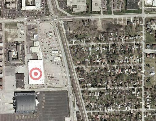
I’m staying at this hotel near Chicago O’hare airport and I go on google maps to scroll around to see what is in the area. I see this giant bullseye on the roof of a building. I stop for a moment, not knowing what it is for… then I realize it is a target logo. Brilliant. Now I know there is a Target store nearby (whether I wanted to or not).
This serves two purposes:
- Online map users can see the store quickly and easily in satellite view
- Airplane passengers see the branding and store location as they’re landing
This is brilliant — a great way to capitalize on satellite imaging for branding.
|
|
See for yourself on google maps: Example 1 - Chicago IL Example 2 - Everett MA (thanks Colonel Kernel) |